Welcome to the Map Editor Web Page
The map editor draws maps that are then used in the simulator. It is also used to draw the model of the robot (i.e the outline, plus sensor placement) and for the sonar beam shape. It also has functionality that support 3D rendering.
Here is the link to download the map editor (48 Kbytes)
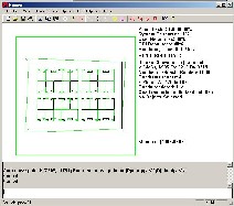
Here is a picture of the map editor drawing the principle map used in the simulation.
Here is a close up of the previous picture, notice that the green lines represent the triangles required to render the roofs of walls. These are automatically generated when using the add depth function in the map editor.
Here is a picture of the model used in the simulator, in terms of its size (drawn by the bumpers) and the sensor placement it is editable inside the map editor, and not hard coded into the simulator.
The 3D support includes adding roofs to walls and tessellating arcs. Here is a picture of an arc being tessellated into 50 line segments with depth added to it, including the 3D roofs (green lines).
A close up of the previous picture.
And of course the arc being rendered in 3D.
The map editor is also used to draw the sonar beam shape as seen by this screen shot.
And of course the 3D rendered version of it.